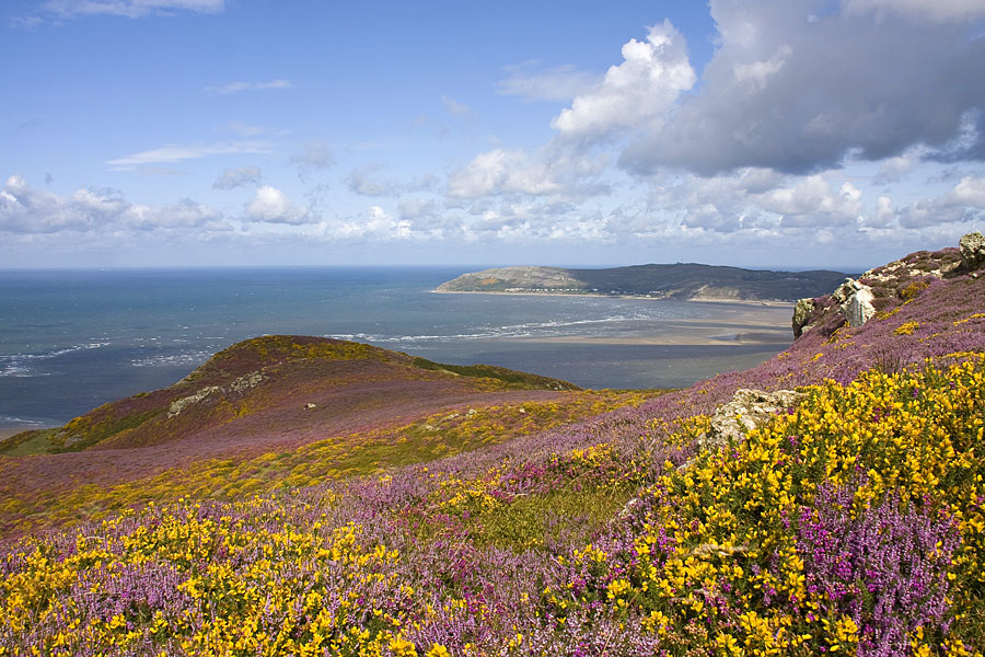
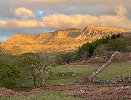
Purple heather and yellow gorse colour Conwy Mountain in late summer
Fiona Barltrop samples the upland Wales Coast Path on Conwy Mountain high above the Menai Strait
SITUATED ON THE NORTHERN EDGE OF THE SNOWDONIA NATIONAL PARK at the opening of a narrow valley that cuts into the foothills of the Carneddau, Abergwyngregyn – usually abbreviated to Aber – is best known for its big waterfall, Rhaeadr Fawr.


It’s certainly well worth walking up to view it if you’ve never seen it. Aber’s also a good base for some bigger walks over the tops of the northern Carneddau. Today, however, it was a stretch of the North Wales Path I had planned, a route I’d done a couple of times before.
Not only was I keen to do this fine walk again, but I was also curious to see whether the new Wales Coast Path also followed the same route, and, if not, how it differed. (No, my OS map wasn’t up-to-date enough to show the Wales Coast Path, and I hadn’t searched online…sometimes it’s good to discover as you go.)
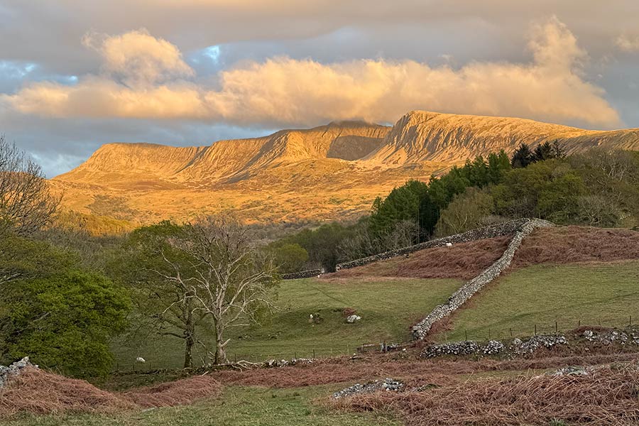
Conwy Mountain (no more than a hill, despite its name) is at its most colourful when the heather is out; the views back over Conwy, its castle clearly visible, are especially fine.
Wales Coast Path way markers
Conveniently enough, Aber village’s bus stop/shelter is just yards from the (free) parking area, with regular buses passing through en route to Conwy. Alighting at the bus stop near Aberconwy School on the outskirts of Conwy is not the most inspiring of starting points but the suburban scenery is soon left behind.
The first thing to catch my eye just before crossing the railway line was a pair of smart, new Wales Coast Path signs with their dragon shell logo, the route ahead indeed following that of the North Wales Path. More signage followed a bit further on with waymarks for both Paths shown.
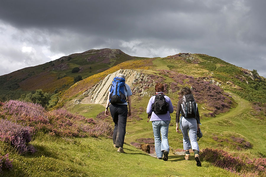
On the upland Wales Coast Path on Conwy Mountain
Conwy Mountain
Conwy Mountain (no more than a hill, despite its name) is at its most colourful when the heather is out; the views back over Conwy, its castle clearly visible, are especially fine. Instinctively I’d have kept as close to the top of the ridge as possible for the best views – notably north towards Llandudno and Great Orme’s Head – which is what I’d done last time, but decided to stick to the route indicated by both Wales Coast Path waymarks this time. That kept to the landward side of the ridge, providing good views inland but obscuring the coastal ones. However, on reaching an information board about the Iron Age hill fort, Caer Seion, on the top of the hill above, I abandoned the official route briefly to climb to the top.
Back on the joint Path, tracks and paths led on down towards the road at the head of the Sychnant Pass. Just before reaching it I spotted a signpost beside the track and here the two Paths parted company, the Wales Coast Path turning off right downhill. I was happy to keep to the higher ground and continued to follow the North Wales Path route, which led across the lonely foothills of the Carneddau. While there are usually people around on Conwy Mountain, wild ponies and sheep keep you company here.
Lowland and upland routes
A bit further on the Wales Coast Path rejoined us. A map showed the route it had taken: down to the village of Capelulo, then back uphill and round the seaward side of Foel Lus – longer and more strenuous than the North Wales Path route. An alternative ‘lowland’ Coast Path route was also shown, running right alongside the coast, but close to the very noisy A55 dual carriageway.
The North Wales Path and ‘upland’ Wales Coast Path parted company again at a fork on the northern side of Moelfre. I kept to the former and a few minutes later passed a signpost with a QR code (there had been others along the way). If you’re into this sort of thing, these are ‘history points’ (this one about an American plane crash here in WWII).
Once across the Afon Llanfairfechan, I followed a delightful grassy path back uphill again, with views across the Menai Strait to Anglesey and Puffin Island; then in the fading light wandered well-contented back down the lane to Aber.
Fiona Barltrop
