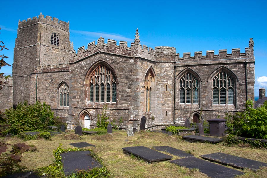
Saint Beuno’s church at Clynnog Fawr, on the Llyn peninsula’s pilgrim trail
Fiona Barltrop takes a wild walk over Yr Eifl, on the remote Llyn peninsula
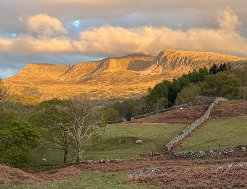
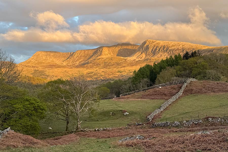
YR EIFL (no connection with the famous Eiffel!) is probably not a name with which most will be familiar. Even among seasoned Snowdonia hill-goers it may not register. As best as my non-Welsh ear can make out, it should be pronounced Yr Ayvel. It’s been anglicised to Rival, hence The Rivals, a locally used nickname, though misleading, since the Welsh actually means ‘the Forks’. Oh, and Llŷn is the Welsh spelling for Lleyn.
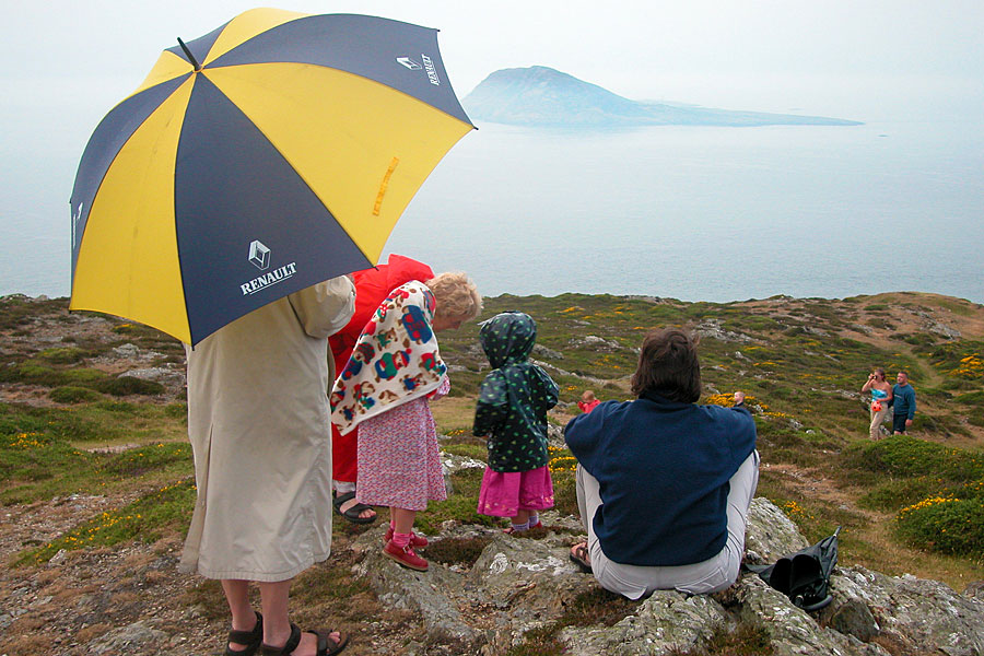
There are three main peaks, the highest a modest 1850ft (564m), but rising steeply, as they do, from a low-lying plain on the landward side and almost straight out of the sea on the coastal side, lends them a particular stature and prominence. Indeed, they are visible landmarks for many miles. Staying in a former slate-mining village on a hill-top a few miles from the Caernarfon Bay coast, just outside the Snowdonia National Park boundary, my eye was constantly drawn to these distant peaks, and indeed those immediately to the north. I was anyway keen to sample some of the Llŷn Peninsula Coastal Path – which takes in Yr Eifl – so it seemed worthwhile forsaking the big hills for a day…
.


Ancient pilgrims’ churches
Clynnog Fawr is a small coastal village with a very fine large church, that of the founder, St Beuno. In Medieval times pilgrims would stop here before continuing on their journey to the tip of the peninsula and Bardsey Island/Ynys Enlli (reputedly the burial place of 20,000 saints…). It’s certainly well worth a look inside before setting out.
The official Wales Coastal Path heads inland with a choice of routes, either along the country lane around the foot of Bwlch Mawr or up between Bwlch Mawr and Gyrn Goch. I chose the latter. Thinking I would bag Bwlch Mawr on the way I headed in a roughly SSE direction up pathless slopes, clambering over some of the rocky outcrops higher up. In the end, I gave the actual summit a miss, with the prospect of the higher Eifl yet to come.
“A series of footpaths took me up to the Bwlch Yr Eifl, then I made a beeline up the obvious path to the highest of the three peaks.“
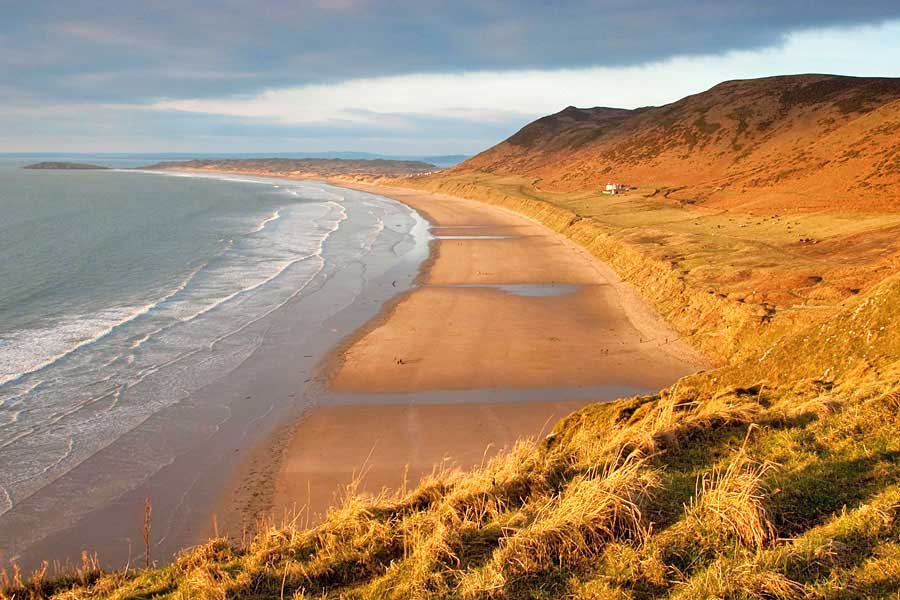
Stunning views
Fiona Barltrop
This article first appeared in The Great Outdoors (TGO) magazine in August 2007, and is re-published here with the author’s permission. Copyright © Fiona Barltrop 2007. All rights reserved.
Fiona Barltrop is a freelance outdoor writer and photographer, with a particular love for coastal walking. She has been a regular contributor to UK walking magazines, including The Great Outdoors and Country Walking, for many years. She is also a member of the Outdoor Writers and Photographers Guild and available for commissions.
Contact: fiona2barltrop@googlemail.com
Books and maps for this part of the coast