Gower walkers

Wales Coast Path: the Route

Walk all around Wales

When the Wales Coast Path opened in May 2012, Wales became the largest country in the world with continuous coastal walking around its entire coast.

Walkers can now enjoy an unbroken coast path around the Welsh seaboard from top to bottom: from the outskirts of the ancient walled city of Chester, on the Dee estuary in the north, to the pretty market town of Chepstow, on the Severn Estuary, in the south.

The official way-marked coast path covers roughly 870 miles/1400 kilometres.

The whole Welsh coast or bit by bit?

Visually stunning and rich in both history and wildlife, the Wales Coast Path promises ever-changing views, soaring cliffs and spacious beaches, sea caves and arches, wildflowers, seabirds, seals and dolphins – as well as castles, cromlechs, coves and coastal pubs. It’s a genuinely special landscape.

Long-distance walkers and hikers will enjoy the unbroken path, the solitude, the Welsh coast’s constantly changing moods and the back-to-nature challenge. Holiday and weekend walkers can recharge their batteries, see something new, and regain a priceless sense of perspective. Families can potter, play and explore. And locals can walk the dog, jog, get fit and rediscover their home patch.

Whether you choose to walk the whole of the Wales Coast Path in one go, in occasional sections, or a few miles at a time, you’re in for a real treat. There’s something new around every corner, and you’ll discover places that can only be reached on foot.

Official route, signs and waymarkers

For the most part, the Wales Coast Path follows a single official route. The path hugs the coast as far is practically and legally possible, occasionally diverting inland around private estates, nature reserves, natural obstacles, estuaries and gunnery ranges. Occasional changes to the official route are notified on the Welsh goverment’s official Wales Coast Path website.

The path uses a mixture of public rights of way: footpaths, bridleways and byways as well as lanes, open access land, beaches and some permissive paths.

On most sections, the route is well-used and clear. In remote or under-used areas, however, walkers will need to pay closer attention to the maps and directions in the Official Guides, and keep an eye out for signposts and waymarkers on the ground.

The Wales Coast Path is clearly signed and waymarked with its own distinctive logo: a white dragon-tailed seashell on a blue ground surrounded by a yellow circlet bearing the words ‘Llwybr Arfordir Cymru – Wales Coast Path’.

Look for wooden fingerposts at main access points, in towns, on roadsides and lanes, and at key junctions.

Elsewhere, the route is clearly waymarked with plastic roundels fixed to stiles, gateposts, fences and walls. In many places the Wales Coast Path waymarkers sit alongside others for already established routes — such as the Isle of Anglesey Coastal Path, the Ceredigion Coast Path, or the Pembrokeshire Coast Path National Trail.

Generally, however, if you keep an eye out for the distinctive Wales Coast Path signs and waymarkers, and the sea on your right (if you’re walking from north to south), you shouldn’t stray too far from the route.

The Complete Wales Coast Path in seven main sections

Choose from the seven main sections of the Welsh Coastal Path – including a complete circuit of the Isle of Anglesey, the Ceredigion Coast Path, and the Pembrokeshire Coastal Path

Great Orme: a limestone headland near Llandudno on the North Wales Coast

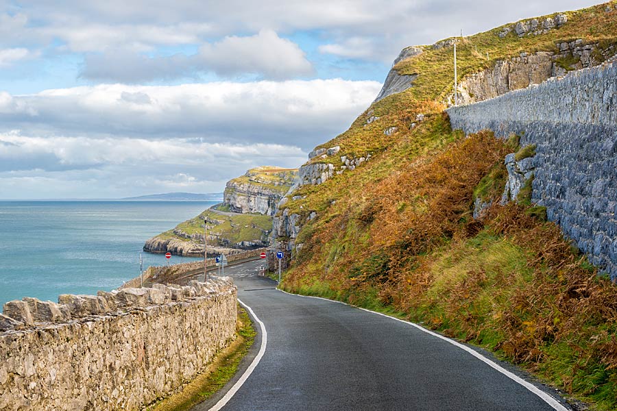
1: North Wales Coast

Chester to Bangor

125 kilometres/ 80 miles
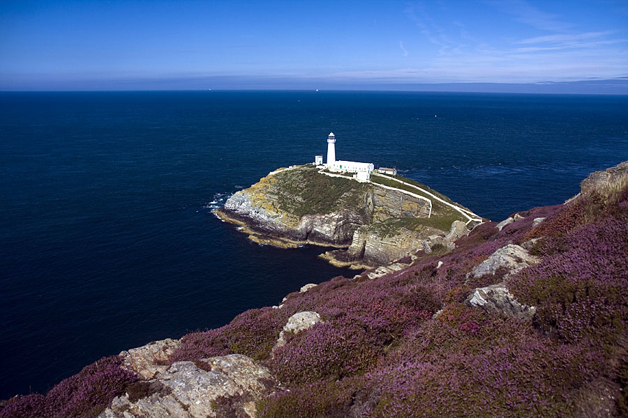
South Stack Lighthouse, on Holyhead Mountain on the Isle of Anglesey

2: Isle of Anglesey

Bangor to Menai Bridge

(Anti-clockwise circuit)

210 kilometres/ 130 miles
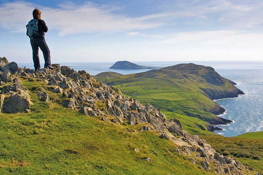
walker overlooking Bardsey Island/Ynys Enlli at the tip of the Llyn Peninsula, in Nort Wales

3: Llyn Peninsula

Bangor to Porthmadog

180 kilometres/ 110 miles

Harlech Castle on its rock in mid Wales, on the Wales Coast Path

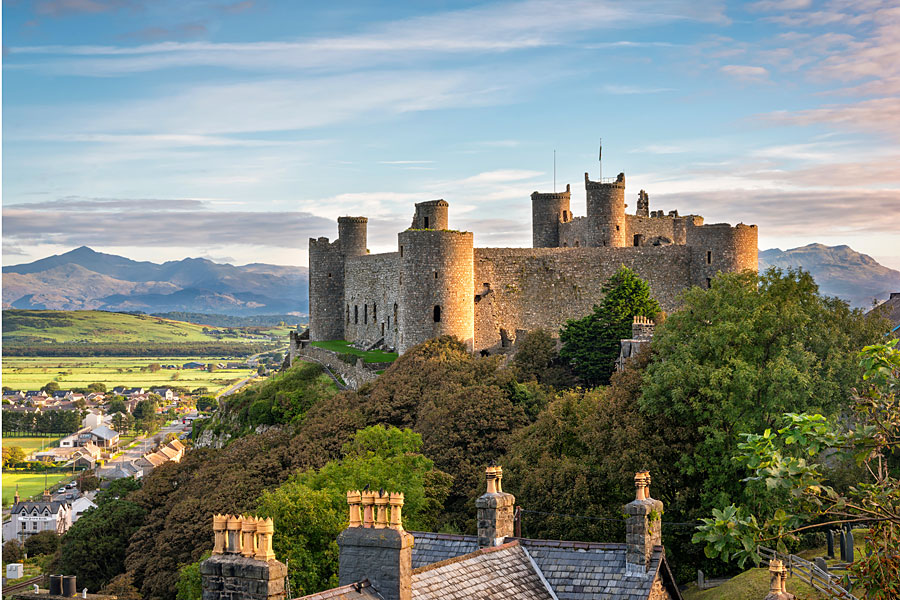
4: Snowdonia and Ceredigion Coast

Porthmadog to Cardigan

213 kilometres/ 132 miles

The Green Bridge of Wales is a natural sea arch on the Pembrokeshire Coast

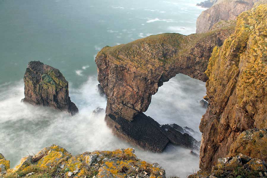
5: Pembrokeshire Coast

Cardigan to Tenby/Amroth

300 kilometres/ 186 miles

Tenby Harbour is a popular tourist destination on the Pembrokeshire Coast

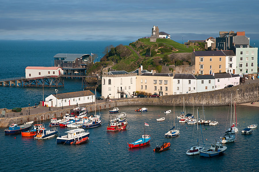
6: Carmarthen Bay and Gower

Tenby/Amroth to Swansea

210 kilometres/ 131 miles

Nash Point is a prominent limestone headland on the Glamorgan Heritage Coast, in South Wales

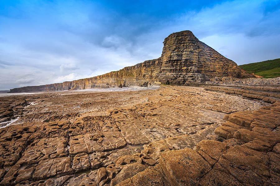
7: South Wales Coast

Swansea to Chepstow

185 kilometres/ 115 miles

Plan your trip

Wales is a dream destination for independent travellers. The Welsh Coastal Path is easy to reach by bus, train and plane, hire car or campervan. Stay in a cosy hotel, holiday home or friendly B&B. And don’t forget holiday insurance. It pays to plan ahead. Book Now

Book a hotel icon #advertisement

B&Bs and HOTELS
Search for and book the best B&Bs, pubs and hotels for your Wales Coast Path adventure

Book a holiday home icon #advertisement

SELF-CATERING
Discover the best local cottages & apartments. Book a lovely holiday home for your trip

Book a holiday home icon #advertisement

TRIP INSURANCE
Be safe. Get the best all-round travel insurance for your Wales Coast Path adventure

Hire a car or van icon #advertisement

CAR & VAN HIRE
Rent the perfect car or van and make the most of exploring the Wales Coast Path

Train icon #advertisement

TRAINS & BUSES
Find and book the best trains and buses for exploring the Wales Coast Path

Book a flight icon #advertisement

FLIGHTS
Search for and book the best flights for your Wales Coast Path adventure