-
Official Guide: Wales Coast Path: Snowdonia & Ceredigion Coast
Porthmadog to Cardigan
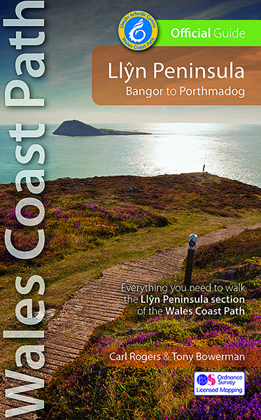
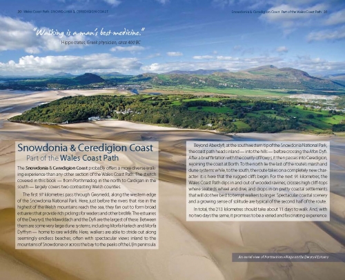
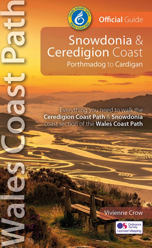
by Vivienne Crow NEW, updated and revised edition – 2022 One of seven Official Guides to the Wales Coast Path The Snowdonia & Ceredigion Coast section of the Wales Coast Path runs for 132 miles / 213 kilometres between Porthmadog in Gwynedd in the north and the town of Cardigan close to the Pembrokeshire border in the south. This guide splits the route into 11 convenient day sections, each of about 6-18 miles / 10-29 kilometres. Day Sections six and seven also provide route descriptions for the complete Ceredigion Coast Path (which, for a few kilometres north of Borth, doesn’t coincide with the Wales Coast Path.) This Official Guide to the Snowdonia & Ceredigion Coast section of the Wales Coast Path contains everything local and long-distance walkers need. COMING SOON -
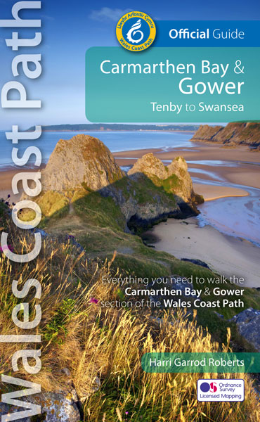
Official Guide: Wales Coast Path: Carmarthen Bay & Gower
Amroth to Swansea
By Harri Garrod Roberts NEW, revised and updated edition - 2021 One of seven Official Guides to the Wales Coast Path The Carmarthen Bay and Gower section of the Wales Coast Path runs for 120 miles/193 kilometres between Amroth, on the eastern edge of the Pembrokeshire Coast National Park, to Swansea, on the landward side of the Gower Peninsula. This Official Guide splits the route into 12 convenient day sections, each of about 10-17 miles / 16-27 kilometres. It contains everything local and long-distance walkers need to enjoy the path. -
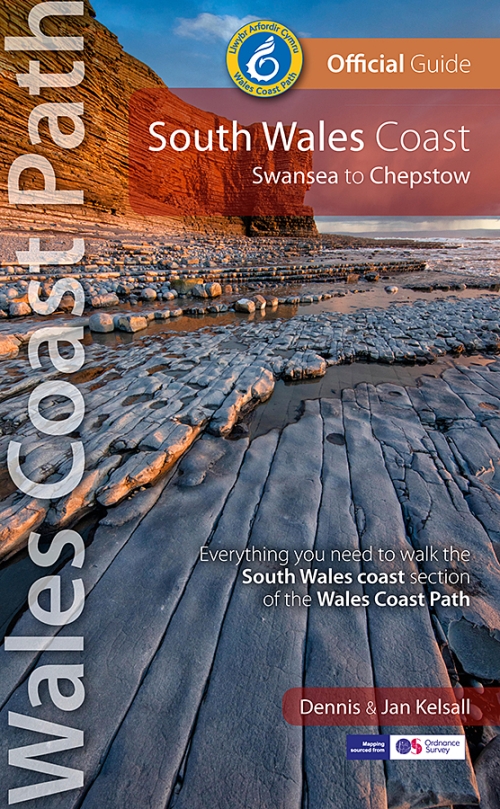
Official Guide: Wales Coast Path: South Wales Coast
Swansea to Chepstow
by Dennis & Jan Kelsall One of seven Official Guides to the Wales Coast Path The 115 mile/185km long South Wales Coast section of the Wales Coast Path runs through unexpectedly varied and dramatic coastal scenery. Along the way are four National Nature Reserves and some 14 miles of designated Heritage Coast, while the deserted salt marshes and mudflats bordering the later stages of the route alongside the mouth of the River Severn are a bird-watchers’ paradise. This Official Guide splits the route into nine achievable day sections, each of about 10-17 miles / 16-27 kilometres. It contains everything local and long-distance walkers need to enjoy the path. -
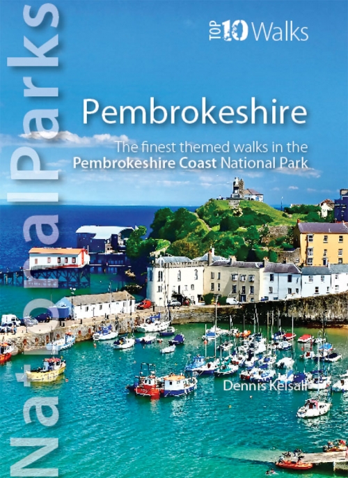
Top 10 Walks: National Parks: Pembrokeshire
The finest themed walks in the Pembrokeshire Coast National Park
by Dennis Kelsall This superbly-written and good looking book will take you on ten short circular walks to the very best stretches of coast, pubs, tea shops, and viewpoints that the beautiful Pembrokeshire coast, in West Wales, has to offer. Defining the south-westernmost tip of Wales, Pembrokeshire’s coastline is arguably the most beautiful and varied in the British Isles. Virtually all of it lies within the Pembrokeshire Coast National Park. Relative isolation has left it largely untouched by modern development and most of its length is a wild frontier where the endless confrontation between sea and land is played out. Long stretches of coast face the fury of Atlantic storms and weakness and faults in the high cliffs are eroded into caves, coves and inlets. However, the harder rock, some of which is 700 million years old, resists the onslaught and stands out in rugged promontories and headlands. Elsewhere, sheltered landings and harbours, fine beaches and secluded bays reveal other aspects of this glorious landscape. In spring and summer the cliff tops break out in the pink, blue, white and yellow of countless flowers and sea crags are alive with nesting birds, while some of Britain’s largest seal populations arrive in autumn to give birth. It was this wild beauty that prompted the establishment of the Pembrokeshire Coast National Park in 1952. Despite being one of the UK’s smaller National Parks, it embraces a third of the county including all the offshore islands, the Daugleddau estuary, and the Preseli Hills. The Park is also home to the popular Pembrokeshire Coast Path — now part of the larger Wales Coast Path. Discover dramatic coastlines at St Davids Head and Strumble Head, Manorbier and Tenby. Climb to lofty coastal panoramas at Carn Ingli and Carn Llidi. Enjoy characterful waterside pubs at Porthgain and Cresswell Quay. Or relax over a quiet cup of coffee or tea and cake at two of Pembrokeshire’s cosiest and most welcoming tea shops and cafés. Unmissable. -
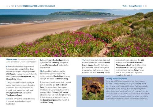
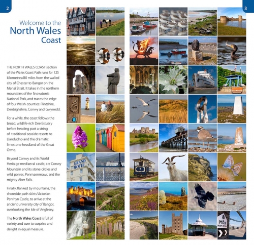
Top 10 Walks: North Wales Coast: Pub Walks
Walks to the best pubs along the North Wales Coast
by Carl Rogers The comfortable, friendly and often upmarket pubs along the North Wales coast complement the walking on this superb stretch of the Wales Coast Path. Each walk incorporates a section of the Wales Coast Path, and starts and finishes close to a great, carefully selected pub. Combined, they cover the very best stretches of North Wales’ coastline, one of striking contrasts and wonderful surprises. The easy, circular pub walks take in the North Wales Coast between Chester and Caernarfon, the Isle of Anglesey, and the remote Llyn peninsula. All the pubs are situated either right on the coast or a short hop inland — some in coves and harbours, some in the dunes or close to clifftops, others almost on the sand — and the majority are open all day. With the pubs often open all year and the walking good in all seasons, the North Wales Coast, Anglesey and the Llyn are quite rightly a year-round destination. -
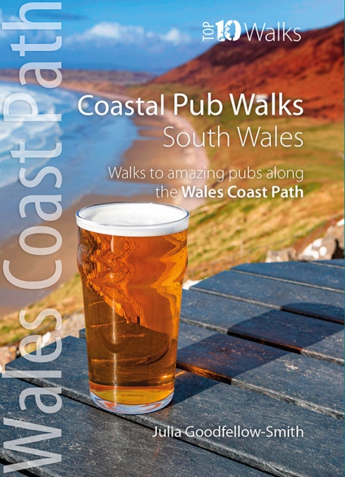
Top 10 Walks: South Wales Coast: Pub Walks
Walks to the best pubs along the South Wales Coast
by Julia Goodfellow-Smith The comfortable, friendly and often upmarket pubs along the South Wales coast complement the walking on this superb stretch of the Wales Coast Path. Each walk incorporates a section of the Wales Coast Path, and starts and finishes close to a great, carefully selected pub. Combined, they cover the very best stretches of South Wales’ coastline, one of striking contrasts and wonderful surprises. The easy, circular pub walks take in the South Wales Coast between Tenby and Chepstow, including parts of Pembrokeshire, Carmarthenshire, the Glamorgan Heritage Coast and the Severn Estuary - as well as Swansea and Cardiff. All the pubs are situated either right on the coast or a short hop inland — some in coves and harbours, some in the dunes or close to clifftops, others almost on the sand — and the majority are open all day. With the pubs often open all year and the walking good in all seasons, the South Wales Coast is quite rightly a year-round destination. -
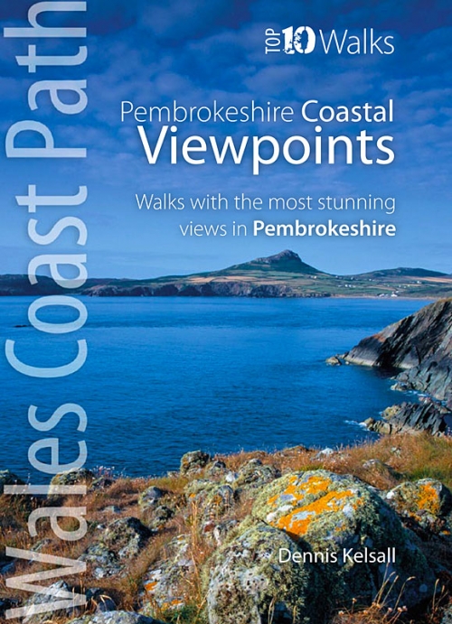
Top 10 Walks: Pembrokeshire: Walks to Coastal Viewpoints
Walks to the best views from the coast in Pembrokeshire
by Dennis Kelsall This attractive and good looking book will take you on ten short circular walks to some of the finest and most iconic views and viewpoints along the rugged Pembrokeshire coast, in West Wales. For some hillwalkers, the ‘view’ is only achieved on attaining the summit. But here, the endless convolutions of the coastline create an ever changing scene, both in front and behind; with every step shifting the perspective, bringing something different into sight. While the distant view can stretch for miles, inlets, coves and bays may remain hidden, only revealing themselves at the last moment. More immediately, the cliffs are broken by crevices, ledges, caves and natural arches, while just offshore are stacks and wave-washed shoals. Behind, the hinterland is a patchwork of hill, common and agriculture, while the vista out to the sea is endlessly changed by the weather, tide and hour. And, where accessible, the prospect from the beach is different again. Memorable walks to unmissable views. -
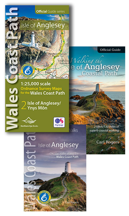
Isle of Anglesey - 10% OFF when you buy all three books
Get all 3 Anglesey books for 10% off the normal price.
- 1:25,000 Ordnance Survey mapping for the whole circuit of Anglesey
- Official Guide to Walking the Isle of Anglesey Coastal Path
- Top 10 Walks: Isle of Anglesey: Circular Walks on the Wales Coast Path
-
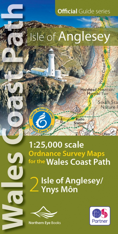
 Enhanced, large scale (1: 25,000) Ordnance Survey mapping in a handy atlas format with all the mapping you need to walk a complete circuit of the Anglesey section of the Wales Coast Path. Continuous OS mapping covering the complete circuit from Menai Bridge. Contains coastal extracts from large scale Explorer maps 262 and 263. The Isle of Anglesey/Ynys Mon Ordnance Survey mapping book is part of a series of map atlases covering the whole of the 870-mile long Wales Coast Path. The enhanced OS 1:25,000 maps are accurate, up-to-date and reliable. Additional map symbols show tea shops, cafes, extra parking, and public toilets. A brief introduction to Anglesey includes a fascinating photo mosaic highlighting notable views, places of interest and wildlife you’ll meet along the way. There is also a section of detailed Useful Information at the back of the atlas. Laminated flapped covers showing Wales Coast Path signs and waymarkers, route details and map symbols make these atlases simple and easy to use. The map books’ dimensions are 215mm x 107mm and they fit easily into a standard map pocket.
- Large scale Ordnance Survey Explorer mapping for the complete coast of the Isle of Anglesey/Ynys Mon in a handy atlas format.
- Highlighted official route of the Wales Coast Path.
- On-map symbols showing amenities at main towns and villages.
- Introduction with attractive photo mosaic.
- Additional useful information
-
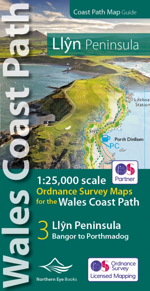 Enhanced, large scale (1: 25,000) Ordnance Survey mapping in a handy atlas format with all the mapping you need to walk the Llyn Peninsula section of the Wales Coast Path. Continuous OS mapping covering the complete, up to date route of the Wales Coast Path between Bangor and Porthmadog. Contains coastal extracts from large scale Explorer maps 253 and 254. The Llyn Peninsula Ordnance Survey mapping book is part of a series of map atlases covering the whole of the 870-mile long Wales Coast Path. The enhanced OS 1:25,000 maps are accurate, up-to-date and reliable. Additional map symbols show tea shops, cafes, extra parking, and public toilets. A brief introduction to the Llyn Peninsula includes a fascinating photo mosaic highlighting notable views, places of interest and wildlife you’ll meet along the way. There is also a section of detailed Useful Information at the back of the atlas. Laminated flapped covers showing Wales Coast Path signs and waymarkers, route details and map symbols make these atlases simple and easy to use. The map books’ dimensions are 215mm x 107mm and they fit easily into a standard map pocket.
- Large scale Ordnance Survey Explorer mapping for the complete coast of the Llyn Peninsula in a handy atlas format.
- Highlighted official route of the Wales Coast Path.
- On-map symbols showing amenities at main towns and villages.
- Introduction with attractive photo mosaic.
- Additional useful information
-
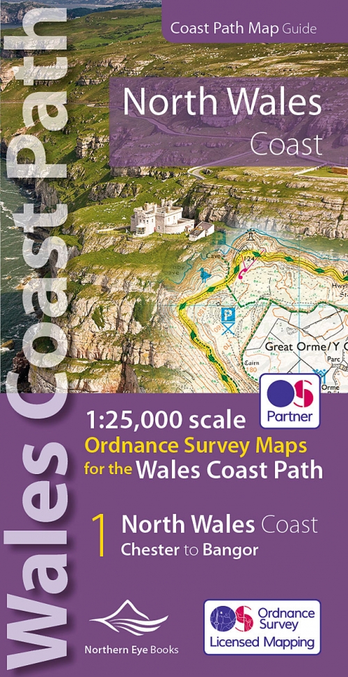 Enhanced, large scale (1: 25,000) Ordnance Survey mapping in a handy atlas format with all the mapping you need to walk the North Wales Coast section of the Wales Coast Path. Continuous OS mapping covering the complete, up to date route of the Wales Coast Path between Chester and Bangor, on the Menai Strait. Contains coastal extracts from large scale Explorer maps 266, 265, 264 and OL17. The North Wales Coast Ordnance Survey mapping book is part of a series of map atlases covering the whole of the 870-mile long Wales Coast Path. The enhanced OS 1:25,000 maps are accurate, up-to-date and reliable. Additional map symbols show tea shops, cafes, extra parking, and public toilets. A brief introduction to the North Wales Coast includes a fascinating photo mosaic highlighting notable views, places of interest and wildlife you’ll meet along the way. There is also a section of detailed Useful Information at the back of the atlas. Laminated flapped covers showing Wales Coast Path signs and waymarkers, route details and map symbols make these atlases simple and easy to use. The map books’ dimensions are 215mm x 107mm and they fit easily into a standard map pocket.
- Large scale Ordnance Survey Explorer mapping for the complete North Wales Coast in a handy atlas format.
- Highlighted official route of the Wales Coast Path.
- On-map symbols showing amenities at main towns and villages.
- Introduction with attractive photo mosaic.
- Additional useful information
-
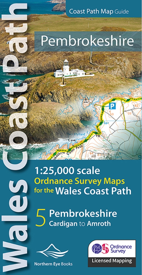 Enhanced, large scale (1: 25,000) Ordnance Survey mapping in a handy atlas format with all the mapping you need to walk a complete Pembrokeshire coast section of the Wales Coast Path. Continuous OS mapping covering the complete route from St Dogmael’s near Cardigan to Amroth, on the Carmarthenshire border. Contains generous coastal extracts from large-scale OS Explorer maps OL 35 and OL36. The Pembrokeshire Coast Ordnance Survey mapping book is part of a series of map atlases covering the whole of the 870-mile long Wales Coast Path. The enhanced OS 1:25,000 maps are accurate, up-to-date and reliable. Additional map symbols show tea shops, cafes, extra parking, and public toilets. A brief introduction to the Pembrokeshire Coast includes a fascinating photo mosaic highlighting notable views, places of interest and wildlife you’ll meet along the way. There is also a section of detailed Useful Information at the back of the atlas. Laminated flapped covers showing Wales Coast Path signs and waymarkers, route details and map symbols make these atlases simple and easy to use. The map books’ dimensions are 215mm x 107mm and they fit easily into a standard map pocket.
- Large scale Ordnance Survey Explorer mapping for the complete Pembrokeshire Coast in a handy atlas format.
- Highlighted official route of the Wales Coast Path.
- On-map symbols showing amenities at main towns and villages.
- Introduction with attractive photo mosaic.
- Additional useful information
-
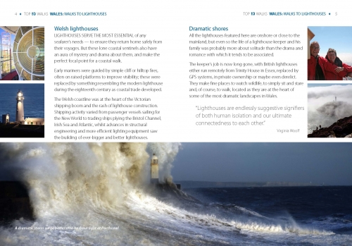
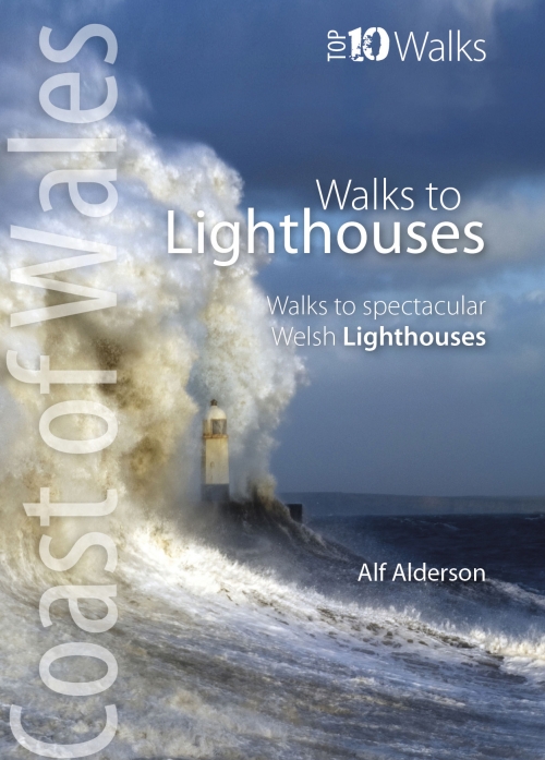
Top 10 Walks: Wales Coast: Walks to Lighthouses
Walks to spectacular Welsh lighthouses
by Alf Alderson The ten walks featured here highlight the very best Welsh lighthouses and the huge variety of the coastline of Wales. From vast expanses of sand, sea and sky, such as at Whiteford Point and Llanddwyn Island, to rugged coastline where seabirds wheel and skrike and porpoise and seals slide through the waves, like Strumble Head and South Stack, these walks to lighthouses guarantee a dramatic, focussed day out. All are circular, and vary from short and easy, like the to Talacre lighthouse, to longer and more demanding, such as that to St. Ann’s Head lighthouse — but none are beyond any reasonably fit and enthusiastic walker. These are some of the best themed walks around today.